Log in
All resources
Create a design
872 Free Artworks of Europe Map
old maps of europe
maps made in the 18th century
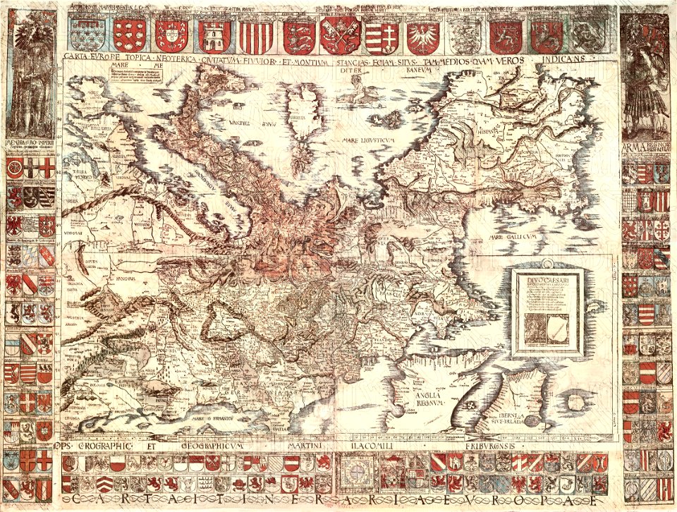
atlantis magni tomus primus (biblioteca comunale di trento)
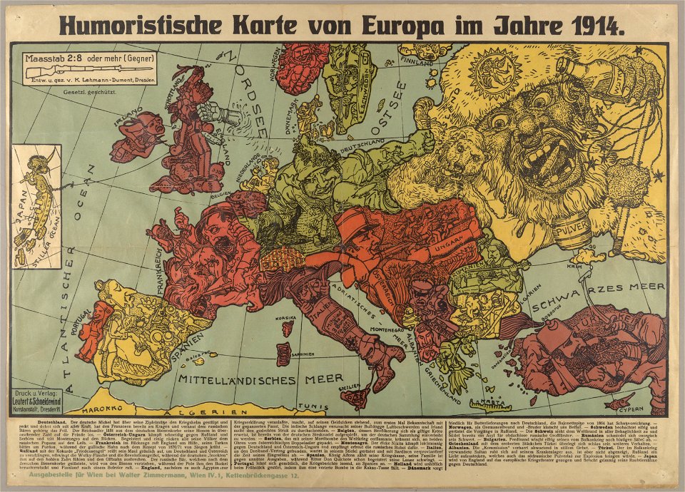
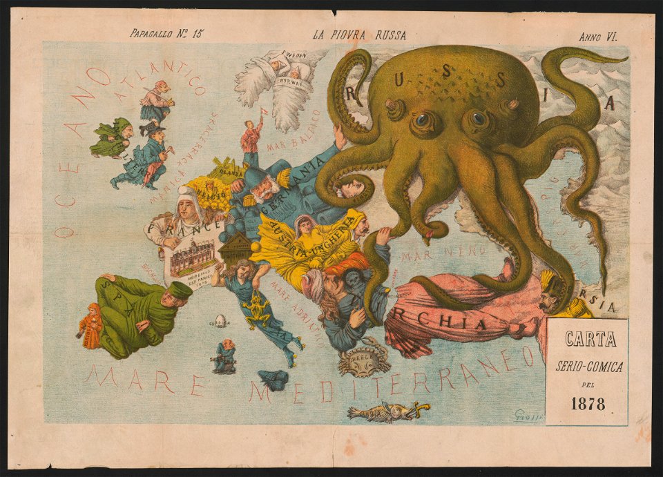
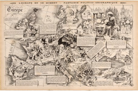
19th-century satirical maps
18th-century engravings
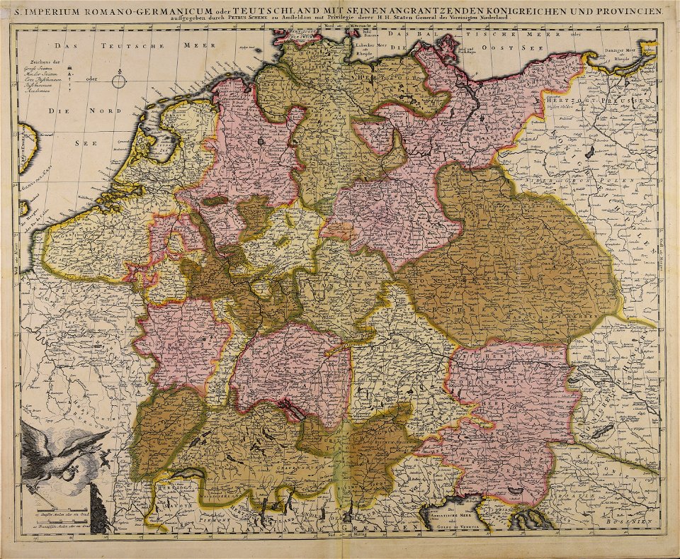
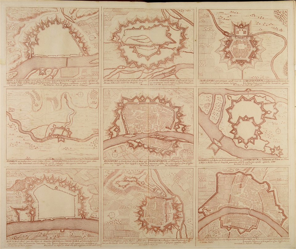
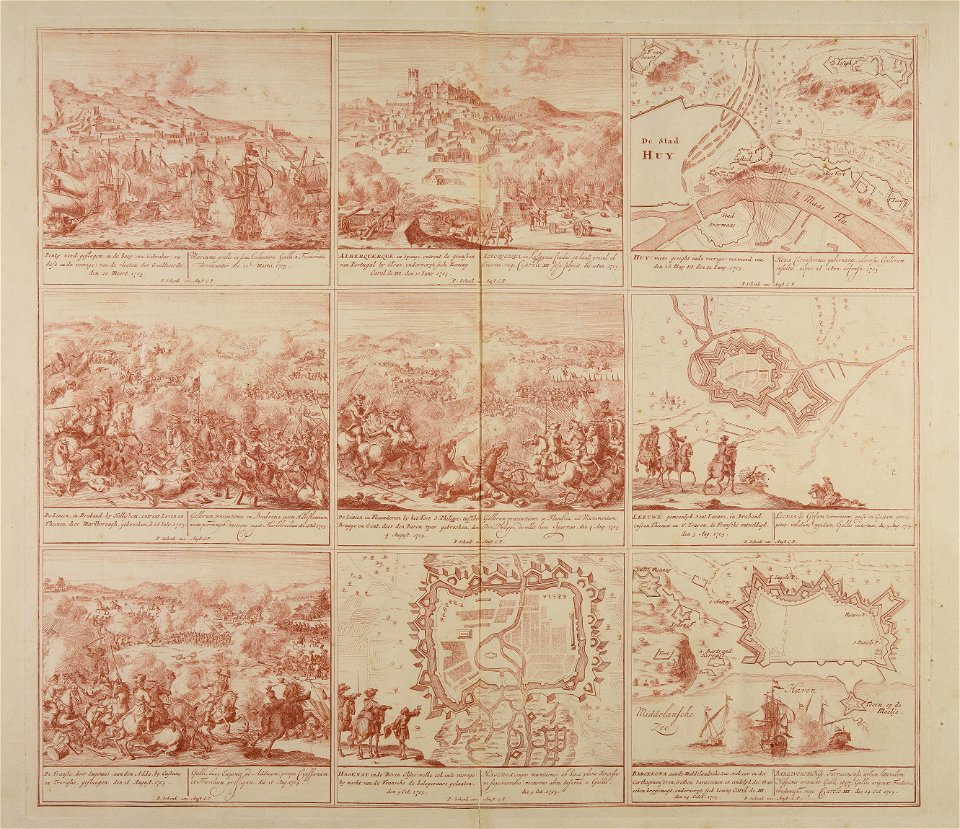
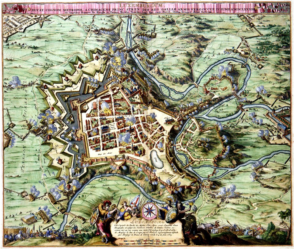
war of the spanish succession
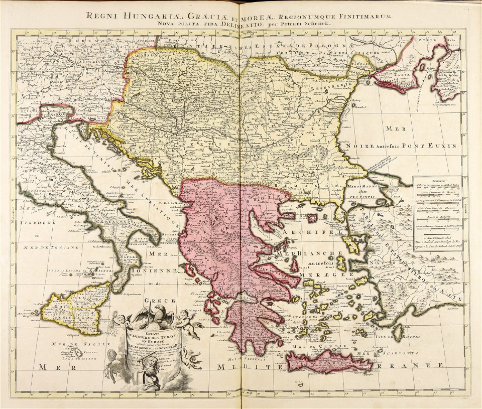
pieter schenk (i)
cities in europe
personifications of nations
fred. w. rose
maps made in the 18th century
old maps of europe
australia
maps
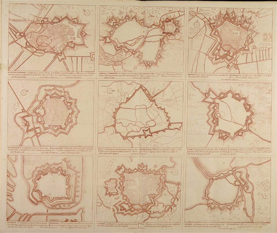
fortified farms
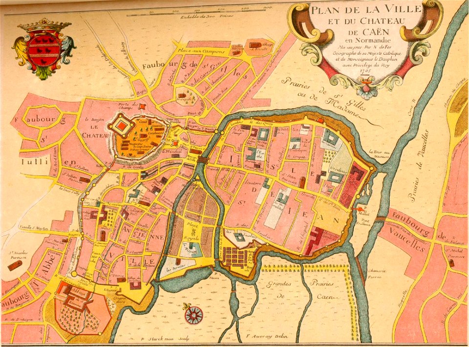
nicolas de fer
encyclopaedia universalis mundaneum
pacific
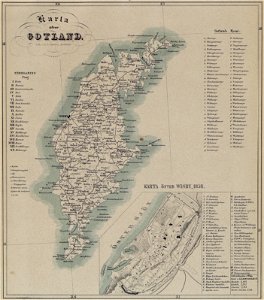
maps of gotland
pehr arvid säve
images from bau- und kunstdenkmäler des regierungsbezirks wiesbaden (volume 5)
german-language maps showing history of europe
1640s maps of france
jan janssonius
old maps of europe
printing
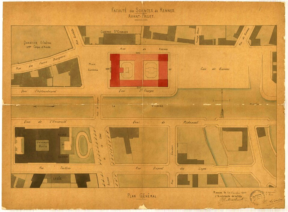
jean-baptiste martenot
1888 in bretagne
jean-baptiste martenot
1888 in bretagne
maps
sea
latin-language maps
armenian
maps made in the 18th century
old maps of europe
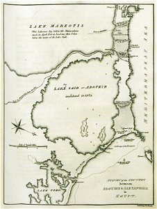
old maps of alexandria
asia and africa
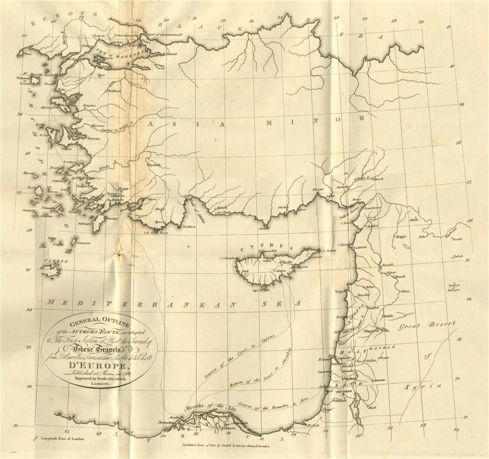
travels in various countries of europe
asia and africa
ocean
maps
cornell university library
political cartoons
maps made in the 18th century
18th-century engravings
maps made in the 18th century
18th-century engravings
maps made in the 18th century
18th-century engravings
maps made in the 18th century
18th-century engravings
maps made in the 18th century
18th-century engravings
maps made in the 18th century
18th-century engravings
maps made in the 18th century
18th-century engravings
maps made in the 18th century
18th-century engravings
maps made in the 18th century
18th-century engravings
new market square in rzeszów
maps of 18th-century europe
maps with cartouches
copper engraving
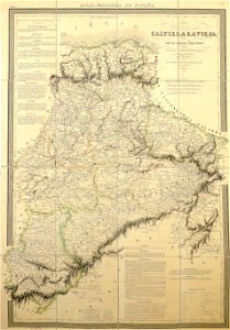
la rioja (spain) in the 19th century
cantabria in the 19th century
coats of arms of galicia (spain)
holy roman empire
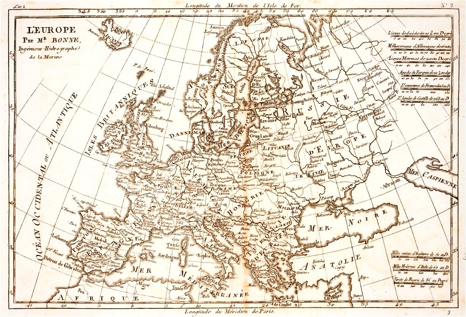
prints from bonne atlas de toutes les parties at the peace palace library
18th-century maps of europe
maps made in the 17th century
old maps of europe
atlantis magni tomus primus (biblioteca comunale di trento)
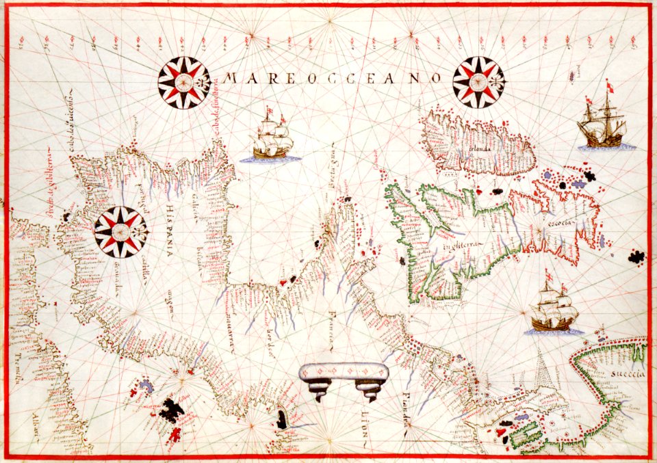
17th-century maps of sweden
maps made in the 18th century
old maps of europe
19th-century satirical maps
europe in the 1870s
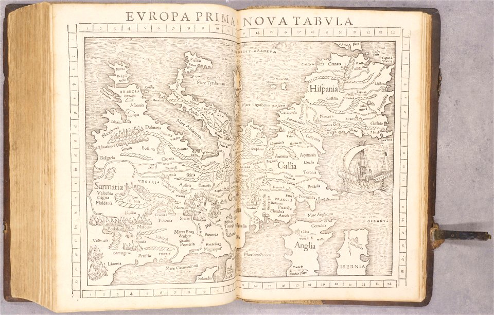
geographiae claudii ptolemaei alexandrini (münster
1552
asia and africa
1813 maps
prints in the royal collection of the united kingdom
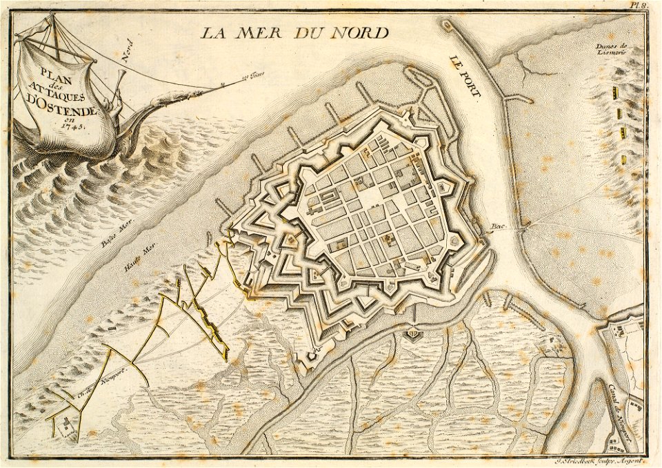
history of ostend
vintage
maps
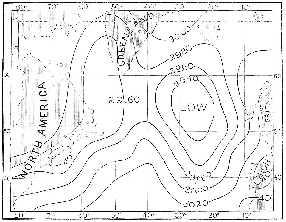
atmospheric circulation
1880 maps
19th-century satirical maps
1899 maps of europe
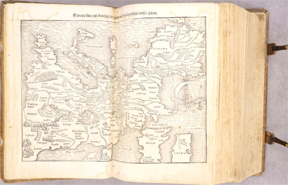
cosmographia - beschreibung aller lender durch sebastianum munsterum (1545)
1540s maps of europe
maps made in the 17th century
guillaume sanson
maps made in the 17th century
guillaume sanson
travels in various countries of europe
asia and africa
maps of luxembourg city walls
maps with cartouches
old maps of india
old maps of tibet
19th-century maps of europe
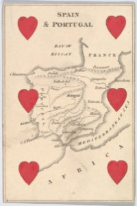
aces of hearts
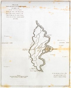
sainte-marie-de-ré
bombardment
don in rostov oblast
novocherkassk
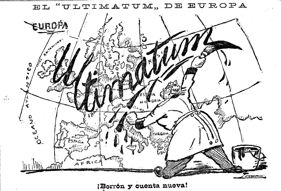
caricatures by manuel tovar in el imparcial
1914
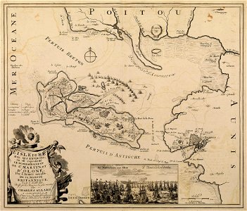
historical images of île de ré
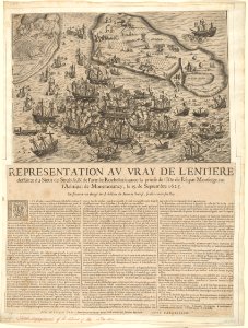
siege of la rochelle
historical images of île de ré
siege of la rochelle
19th-century satirical maps
1899 maps of europe
historical images of île de ré
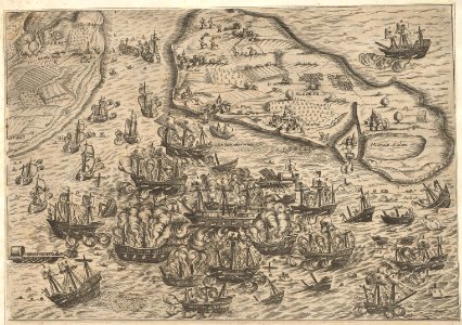
siege of la rochelle
prints in the museum boijmans van beuningen
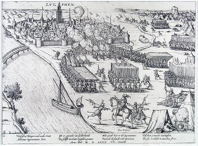
frans hogenberg
historical images of île de ré
siege of la rochelle
historical images of île de ré
siege of la rochelle
prints in the royal collection of the united kingdom
battles involving the united kingdom
franco-prussian war
prussia
artworks without wikidata item
6 of hearts
russo-turkish war (1877–1878) in art
great eastern crisis (1875–78)
russo-turkish war (1877–1878) in art
great eastern crisis (1875–78)
cornell: persuasive cartography: the pj mode collection
russo-turkish war (1877–1878) in art
caricatures
cartoons
old cartoon maps of europe
1870 cartoons
old maps of banská štiavnica
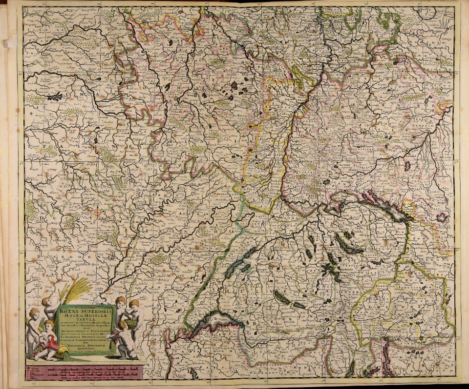
danubius pannonico-mysicus
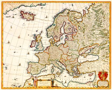
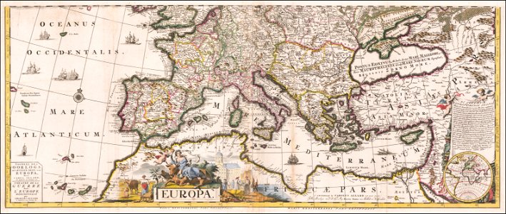
map of europe by guillaume delisle (1700)
1789 maps of europe
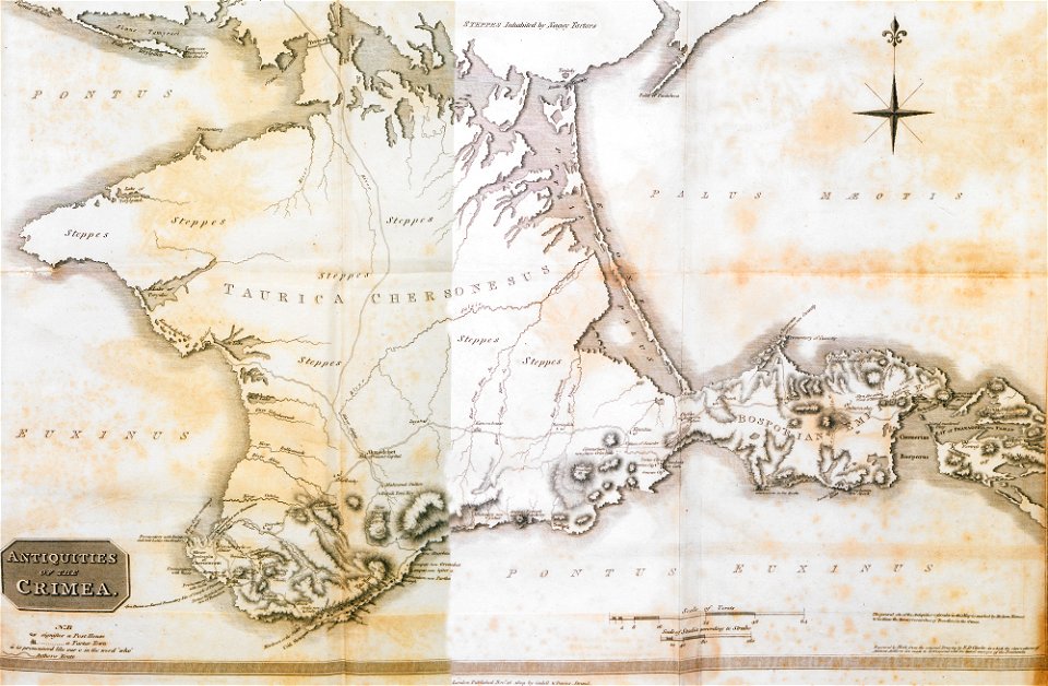
17th-century maps of the black sea
maps by willem and johannes blaeu
1550s maps of the iberian peninsula
renaissance
maps by john cary
county of tyrol
synopsis universae philologiae
maps of continents
17th-century maps of the black sea
maps by willem and johannes blaeu
jean étienne guettard
philippe buache
maps by carolus allard
1705 maps of europe
1370s maps of egypt
catalan atlas
maps by willem and johannes blaeu
17th-century maps of europe
1570s maps of the ottoman empire
1576 maps of europe
synopsis universae philologiae
1741 maps of europe
old maps showing history
1820s maps of europe
cornell: persuasive cartography: the pj mode collection
europe in the 1870s
victor levasseur - maps of the world
coats of arms of switzerland
maps of eastern europe
french-language maps
ethnographic maps of austria-hungary
1890s maps of austria-hungary
maps by cornelis anthonisz.
1560 maps of europe
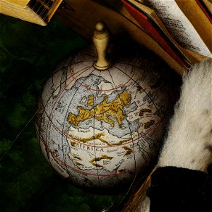
high-resolution details of the ambassadors (holbein)
german renaissance,northern renaissance
german renaissance,northern renaissance
details of the ambassadors (holbein)
alphabet charts
lord's prayer
1690s maps of eastern europe
maps by carolus allard
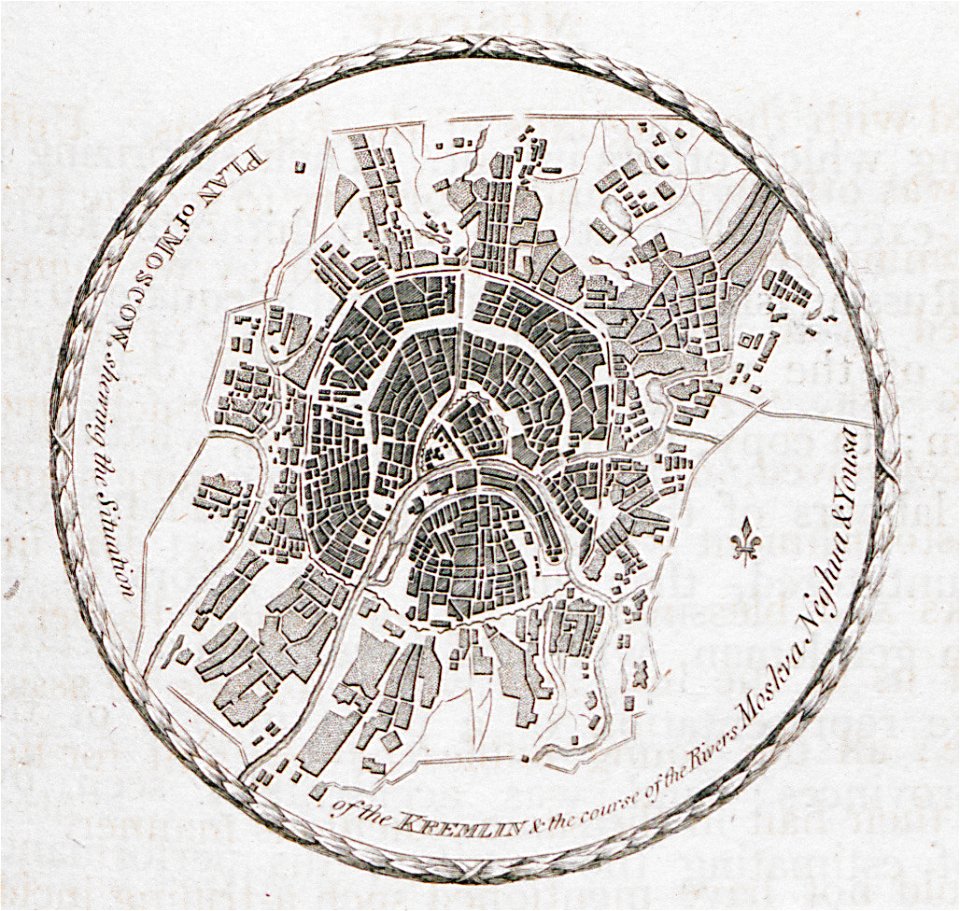
maps in the library of congress
1870 cartoons
john spilsbury
puzzle maps
fra mauro map details
1450s maps of europe
jean étienne guettard
philippe buache
german-language maps from ios map collection
18th-century maps of the black sea
17th-century maps of the mediterranean sea
guillaume sanson
1801 maps of europe
maps by john cary
atlas van der hagen (volume 1)
atlas van der hagen
media from the national library of finland
classicism
1375 maps of europe
catalan atlas
1375 maps of europe
catalan atlas
201 - 300 of 872
Next page
/ 9